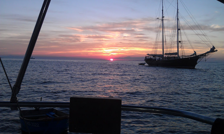
July Night in Menemsha Bight

July Night in Menemsha Bight

Monday, August 27, 2012

Bathrooms, Ice, Laundry - New Bedford Harbor

You can re-arrange the order of these items, but bathrooms, ice and laundry are usually the first three concerns my crew has after a few days out.  Pope's Island Marina is probably the simplest solution to a visiting boat.  Pope's is run by the city of New Bedford and is located on Pope's Island, pretty much in the center of the harbor as you come in.  It is easy to access.  The marina and the staff associated with it and harbor management monitor Channel 9 and 74.  Once you get someone from the Harbormaster's crew, they are very welcoming.  They've usually got "harbor attendants" out and about in the harbor, welcoming visiting boats and trying to assist them with their needs.  Your needs might be met at Pope's Island, but the harbor staff will help you regardless of whether you are using Pope's or not.


Even if you are not staying at Pope's, you may use it for its pump out facility or for buying ice.  For either, you pull up to the floating dock they have on the face of the outermost dock.  You can get block or cube ice.  You can get a pump out.  There is a water hose.  The staff if efficient and courteous.  Always friendly, which is great.  Now, Pope's has showers and laundry facilities at the head of its dock system.  If your boat is a paid customer of the marina, you can use these facilities.  I don't know if there is a daily fee that a non-paying cruiser can pay to use these facilities.  I have been trying to find that out and will report when I know the answer.  As I mentioned in an earlier post, there is a new dinghy dock to the east of Pope's dock complex.  It is used by the rowing organizations and seasonal dinghy dock renters, but it is also available for transient use to access Pope's Island, its parking lot and businesses on the island.  The poor man's bathroom solution if using the dock would be to cross the road and go over to Dunkin Donuts for a coffee.


Pope's has space for transients in slips and the city has some moorings in the mooring field in front of the marina.  Again, I don't know if the mooring customers get use of the showers and laundry facilities, but the slip customers do.

I'll revisit the issue of bathrooms, ice and laundry in coming posts, but thought I'd feature the public facility first.  Pope's Island, itself, has three other marina type outfits with various levels of offerings.

Be careful approaching Pope's Island from the Southeast.  The area around Crow's Island gets very shallow (wading depth).  Better to approach in main channel and then turn east along the front of the docks or down one of the rows of the mooring field as you get abreast of it.

Friday, August 24, 2012

Dinghy Docks - New Bedford Harbor

There are three public dinghy docks maintained by the City of New Bedford in the inner harbor.  The first is at the Gifford Street location, which I discuss in the post before this one.  If you are leaving your dinghy here for any time, you want to lock it up.

As you proceed further into the harbor from the barrier there is another public dinghy dock on the south side of what is known as State Pier.  The north side of the pier is used by the fast ferries.  The face of the pier usually has some large yacht or little cruise ship on it.  The dinghy dock is located where the south side of State Pier and the intersects with pier boardwalk.   You won't necessarily see the dinghy dock until you enter into the passage between the docks in this area.  You will see large fishing boats stacked up in this area and you will think you might not belong, but you do - just keep heading in.  The dock is a floating dock with ladder up to sort of boardwalk area.  This area is where there is a small "park" dedicated to the Coast Guard.  There is not much mention of this "park" in many maps of the area, but it does exist with a little monument.  If you tie up here, you will enjoy walking the docks in this area and checking out the boats.  Cross the street (very wide) and you will be in the historical area of New Bedford with great restaurants, bars, stores, museums, and such.  I'll go into a little more detail in another post on what you might find in this area, but it is where the action is.  National Park service has a little facility in this area as well a a larger facility across the street and in the Historical area.  You will see State Pier in the photo below.  Dinghy dock is between the docks to the left in photo and can't be seen in this one.


The third dinghy dock has only been around for a year or so.  It is located on Pope's Island.  Pope's Island is the relatively large island in the middle of the upper harbor.  A bridge from New Bedford to tiny Fish Island then crosses over to Pope's Island, then crosses over to Fairhaven.  The section from Fish Island to Pope's has an antique swing bridge which allows passage further north in the harbor, but you are not going that far to get to the dinghy dock.  The dinghy dock is on the south side of Pope's island, to the east of all of the docks associated with Pope's Island Marina (owned and managed by the city of New Bedford).  It is a long floating dock, leading up to a playground, green area, adjacent to a public parking lot.  Unless you are renting a mooring or a slip from Pope's Island Marina, you do not have access to the showers, laundry facilities or other limited amenities at the marina.  You can use the parking lot and green area.  Across the street (Rt. 6) from the dinghy dock is a large hardware store that has a small, but healthy marine hardware section and should be checked out before you go over to West Marine, which is also just across the street.  There is a Dunkin Donuts on the island, a strip club, a restaurant, and some marinas which I'll talk about in another post.  There is no reason you can't tie up at this dinghy dock and walk into either New Bedford or Fairhaven to see some sights.


You cannot see the dinghy dock in this photo as it had not been constructed yet.

The link below, if I've done it correctly will show you a nice map that the harbor authority has published showing the dinghy dock locations.


http://www.portofnewbedford.org/documents/Inner_Harbor_Map.pdf


Thursday, August 23, 2012

New Bedford Harbor - Gifford Street

So, where can you moor or anchor in New Bedford Harbor?  There is a link to the New Bedford Harbor Commission under the links section and you can see the official policies.  There is a map under the anchoring section that does a nice job showing general parameters within the harbor.  When you enter the harbor, if you round Palmer Island, which is on your left, a cove is formed by the island, the back of the hurricane barrier and the commercial docks.  This area is generally known as the Gifford Street mooring area.  There is an established mooring field here that has grown in size recently and may be modified again in the future due to the fact that the Cape Wind Project intends to use the abandoned commercial pier area to construct a large staging area for its windmill turbines on their way to Nantucket Sound.  Most of the moorings in this field are private, individual moorings.  Bayline Boatyard (which is located at Gifford Street, in back of the public parking lot) has moorings there as well that they rent to transients.  I believe Whaling City Moorings and Launch have a few for rent there too.  You will see boats anchored on the edge of the field and they don't appear to be bothered by the harbor patrol.  I have anchored there and was not bothered.  Check your chart regarding depth and obstructions in trying to find a location.  By the way, the Whaling City outfit is the only one I know that provides a regular launch service in the harbor.  You don't have to be on one of their moorings.  They'll come get you anywhere for a price.  Whaling City has other rental moorings in the harbor other than at Gifford Street.  Bayline used to be located years ago on Pope's Island, further up the harbor.  It is busy, well regarded yard.  A lot of boats are stored there in the winter and their facilities are supposed to be top notch.  They are frequently called on to use their rigs for over the road boat transportation, as they've got gear that many other marinas don't have.  Bayline accesses the harbor through the town parking lot and uses the town ramp and dock at Gifford Street.  Anyone can use these facilities, so if you need a ramp, or a place to park, pick up someone, or drop someone off, it is a good spot.  The moorings at Gifford Street are pretty well protected and it is relatively quiet there.


You are a long dinghy ride from downtown proper.  If you dinghy into the Gifford Street dinghy dock, other than Bayline, there is nothing for you to do really.  You will be in an old section of town with abandoned mills.  No showers, no stores, no bathrooms, no shelter.  If you are adventurous, there is a public fish market that is open certain days to sell fresh fish off the boats on or about Blackmer street, which is walkable.  There is also a Pricerite that you can walk to by walking up Gifford Street to JFK and then walking north on JFK to its intersection with South Street.  This is an excellent grocery store for price and variety.  It has got food that caters to local ethnic populations and that makes it fun and different from run of the mill Pricerites.  It is the first grocery store that I've been to for a while that has security guards - so, that adds to the experience. 

As I said, this is a working class, somewhat depressed area of town, so if you are looking for a tiki bar and someone to exchange your burgee with, it is not going to happen at Gifford Street.  If this type of neighborhood turns you off (and that's okay), don't judge New Bedford by it.  The city has a lot more to offer, so give it a chance.  Dinghy or take the launch to the docks further up the harbor.  Call a taxi and get a ride into town.

New Bedford Harbor - Inside the Hurricane Barrier

Inbound, after you pass through the hurricane barrier, you are presented with a large, active harbor.  New Bedford is still on your left and Fairhaven is still on your right.  There are facilities and sites on both sides for visiting sailors.  The harbor is also the mouth of the Acushnet River.  The Fairhaven side is where Slocum put the Spray in to begin his journeys.  A leading Fairhaven family involved profitably in the China trade were the Delanos.  This is where the "D" in FDR comes from.  FDR's mom was raised in Fairhaven and he spent a lot of holidays there growing up.  The Delano home is now a bed and breakfast.  In the good old days, there was a Delano wharf off of Fairhaven.  Over by Moby Dick Marina, well up into the harbor is a large cemetery named Riverside, that was apparently funded at its inception by the Delano family.  If you are into grave hunting, drive in to the back and you will find a large crypt with many of the Delanos that you would read about if delving into FDR's ancestors.


On the New Bedford side, you will see a commercial waterfront, with a large part of the harbor's fishing fleet tied up in various locations.  Fish intake and processing facilities, ice houses, and a ferry dock among other things.  You will see all manner of boats/ships in the harbor.  Small cruise ships, mega yachts.  Whale boats being rowed by crews for fun and exercise.  Rowing sculls from a local rowing program.  Tug boats, barges, rowboats.  You can usually see the Hannah Boden around.  This being the boat Linda Greenlaw captained in the Perfect Storm saga.  I believe she also used it for one of those dangerous catch type shows on TV.  I thought the boat was moving up to Maine, but I still see it in the harbor quite a bit.  In downtown New Bedford, there is a very nice historical area that contains the Whaling Museum, the Seaman's Bethel, restaurants, National Park visitor center and little shops.  If you like Moby Dick, you'll like the fact that you can visit the area and many of the buildings and sites that he speaks of.  There is a public dinghy dock that you can use to access this part of town which I'll describe in a later post.


When you first enter the harbor, you will see a picture perfect little lighthouse off of Palmer Island on your left.  If you are going to get hung up in the harbor, the water around the north of Palmer Island might be the place where it will happen.  They've put moorings into the pocket area southeast of the island and there is a large mooring field on the west side of the island (Gifford Street mooring field); but watch your chart in this area and make sure you are in the channel or east of it, when you enter the harbor from the barrier.


I am bouncing you back and forth, but as you enter the harbor from the barrier, on the right you will see the beginning of the Fairhaven Shipyard complex.  This facility has gotten larger and larger, gobbling up some other properties over the years.  It is divided into the North and South yards.  Gas and diesel is available at the South yard as you enter the harbor.  This complex has got it all from soup to nuts.  It has got a marina and works on anything from small boats to ferries to fishing boats.  It really dominates the waterfront on the Fairhaven side.  It has a great reputation, but I don't have a lot of personal experience with it other than buying fuel.


Wednesday, August 22, 2012

Coming In To New Bedford Harbor

There may be some lingering prejudices about New Bedford Harbor.  I have not met a sailor, though, who has come in lately who has not been impressed with the harbor.  Since the harbor is set so deep into the coast, visiting represents a time commitment that many avoid.  More and more people are appreciating it as a distinct destination, though, and it deserves that reputation.

The approach to the harbor from the middle of Buzzards Bay is easy enough by following the channel which begins at G1 and R2.  This channel is a super highway.  It is relatively straight and well marked.  Like any super highway it can be crowded, so you've got to keep a good lookout, 360 degrees, for what is coming from any side.  Ferries are active in the channel as they service Martha's Vineyard and Cuttyhunk from the harbor.  Tugs and barges are around.  New Bedford has one of the country's largest commercial fishing fleets, so you will pass, or be passed most likely, by large fishing boats.  Also in the channel will be charter fishing boats of all sizes.  Add to that pleasure craft of all types.  Sailboats, powerboats, jet skis.  As you progress down the channel, the shore on your right (Sconticut Neck) represents the town of Fairhaven.  Soon, the land on your left, with a fort on the end (Taber/Rodman) represents the town of New Bedford.  A little past the fort on your left, you will make out the Butler Flats Lighthouse, which is not on land, but to the left of the channel.  If you don't already have a picture of this light on a calendar or a towel or post card, take a picture.  It's a nice light.  If you lose the channel in rain or fog, but can get a fix on the Butler Flat Lighthouse, the channel can (G11) is just to the east of the structure.


As you get close to Butler Flats in the channel, I shy away from the water to the east.  The chart shows a lot of 1's, 3's, 4's and such.  You will see boats there and I know there is good water there in places, but for me it requires too much concentration to have fun.  The shore on the east side (Sconticut Neck) is all residential with some local beaches.  Conversely, on your left (the westerly,  New Bedford side) as you are entering, has plenty of good water.  In fact, if you are tired of the channel, or just want to give the commercial shipping some relief, get on over to the west between Butler Flats and the hurricane barrier and do some sailing.  The shore on this side is a mix of public beach, old factory sites, residential, and one good shore side restaurant named Davy's Locker.  If you are hungry, anchor off the small beach adjacent to Davy's Locker and row in and get some seafood.  In the summer, they open an outdoor section on the edge of the water to create a beach club type vibe.

Back to the channel and entering the harbor, you will approach the hurricane barrier, which will be obvious to you as an opening in the massive dike that protects the harbor.  Since this is a choke point for all the traffic that I describe above, you should be alert as you approach and go through the barrier.  There is plenty of room.  More than one boat can pass through at the same time (depending on the boats).  It is well marked, and sort of fun.  Depending on what the tide and current is doing, the water can get a little weird as you pass through the barrier.  You can go through with your sails up, but if you've got a motor, you may want to have it running or able to start quickly.  The barrier is large enough to block most of the steady breeze you were just enjoying as you entered the opening.  It is possible, under sail, to come barreling into the opening and find yourself becalmed with not enough momentum to get through the break.  If you have no power, you can do it, but look for a break in traffic first and get in a position on entry where you've got some leeway to play with while you wait for the wind to catch you on the other side.  The barrier is run by the feds and you don't hear much chatter from them.


Now you are in the harbor and I'll talk more about that in the next post.  I will mention that the commercial fleet in New Bedford are universally kind and considerate to sailors.  They may contact you, or you may want to contact them at or around the barrier to be sure of your intentions.  The Martha's Vineyard ferries are high speed.  While you may have the right of way at the barrier, you may also want to give them or others the go ahead.  They appreciate it, but do not insist upon it.  Everyone shares the harbor well.
Tuesday, August 21, 2012

Padanarum (Dartmouth)

Leave New Bedford and take a right at Fort Taber and ahead of you, a few miles away, you will see a forest of disembodied masts representing the impressive fleet of sailboats lying at anchor in Dartmouth's harbor (more popularly known as Padanarum by boaters and those in the know).  Before you get to Padanarum, though, you will sail across the mouth of Clark's Cove which is a large open harbor that contains few obstructions and some nice protected sailing.  But we'll leave that for another day.  Mind your charts as you approach Dartmouth from any distance in any direction.  There are rock outcroppings littered within the general environs.  As you approach the harbor, you will see the harbor breakwater extending from the shore on the right.  A short section of breakwater, closest to eastern shore, has disappeared from storms leaving an apparent gap.  This gap is not navigable.  The rest of the breakwater is still there below the surface.  Enter the harbor, leaving the end of the breakwater and its marker on the end to your right.

All of the various cruising guides that give some attention to Padanarum talk about hanging a right, immediately after entering past the breakwater and finding anchorage there.  This was probably possible when these guides were written, but the mooring field now populates the entire area behind the breakwater.  There is not only no real room to anchor, but it is specifically prohibited.  What is being left for those of us who like to anchor is the area on the left as you pass the breakwater, up to the beginning of the other mooring field which begins on that side.  This is not a well protected area and it is a long dinghy ride to the head of the harbor.  The holding is fine, but you get a lonely feeling anchored there watching the protection afforded to those fortunate enough to be protected by the breakwater or the inner confines of the harbor.  The prevailing breeze is from the S-SW in the summer and there is not much to stop what is coming at you from Buzzards Bay.  There might also be some spots to anchor further into the harbor on the left side of the channel, but it is hard to get this clarified, and Padanarum, like many popular harbors around here is now heavily polluted with moorings.


In terms of transient moorings, that can be confusing.  Davis & Tripp advertises transient moorings, but I've not been able to determine what their rate is.  There is an application form on their site.  The harbormaster's site says that Concordia (which is not on the water) has transient moorings, but I can't confirm or comment.  The New Bedford Yacht club (which is headquartered not in New Bedford, but in Padanarum) has some transient moorings, but I have been told over the radio that they don't. The harbormter's site says they do. South Wharf is a marina in the harbor, but I believe it only has slips.  I can't comment on transient slips at any of these places, because I've never used them or sought them out.  I will say that the harbormaster's office has been very helpful in finding me a place to either stop and have a sandwich or help me find someone to rent me a mooring, so don't despair.

The harbor is very pretty and focused on sailboats.  You will see some nice sailing done by dinghies and large yachts from early morning to evening.  One nice thing about the outer anchorage is you can watch a parade of sailboats going in and out of the harbor all day.  There is a public dinghy dock to your immediate right after you pass under the bridge separating the north and south harbor.

Downtown is a little odd.  Nice homes, and a Main Street with cute retail spaces that seem to all be filled with real estate offices, selling the properties that you have been ogling either on the way in by boat or car.  There is a little liquor store/market that sells ice.  An ice cream place over by the bridge and a little restaurant or two.  A couple yacht brokers, marina, and the New Bedford Yacht club.  Across the bridge from town is a nice public space with a boat launch, beach and such.

We often will sail over to Dartmouth when we are short on time but want to go somewhere.  We throw out the anchor have lunch, take a swim off the boat and head back to New Bedford.

Monday, August 20, 2012

Just Starting

I am dipping a toe into the blogging world with some trepidation.  I've spent the last few years following some excellent sailing blogs.  I have watched many good ones die on the vine and some stay up and active.

Probably the slickest sailing blog out there is Windtraveler.  This couple started out in Chicago last year, came down the canal, out the Hudson and ultimately to Grenada.  The writing is very good, but is more lifestyle based than technical sailing stuff.  The actual sailing segments of the blog do not go into much detail, but I believe that is intentional.  Who knows?

Another excellent writer is from the blog Our Life with Ceol Mor.  She does not update her blog as often as Windtraveler and sometimes the topics drift away from the boat, but when she is writing about their re-fit adventures; their plans; her husband; and the short little shake downs away from the dock, she is one of the most entertaining writers out there.

Another good, entertaining writer comes from The Dock Six Chronicles.  He variously has got some technical how to project going or some equipment malfunction or sailing adventure.  I believe his boat is on one of the Great Lakes in Canada.  Interestingly, among these three blogs, he has probably sailed more in the last year than both of the others.  The Windtraveler folks shut the boat down for hurricane season and having a baby and then decided to buy another boat.  Ceol Mor is apparently being meticulously fitted out for a well planned cruise a year or more from now.

The best writer out there is a guy who has not posted anything since June.  His site is The Fakes Progress.  I forget the entire story, but at the age of 60, I believe, someone bought him a Pearson 26 as a birthday present.  He keeps it moored at the 79th street basin in NYC, but each summer except for this one, apparently, he sails the thing solo to Maine and back.  Beautiful, funny writer.  Braver than I in terms of striking out alone.  Sailing alone through any conditions.  Sailing at night.  Anchoring wherever, at will.  He's an inspiration.

Last, but not least, for this first post that is turning into an unintended blog/writers review, is what was a self published e-book and its attendant website.  The book is no longer available as an e-book, because it has been picked up by major publishers.  The movie rights have been sold.  An incredible success story for a young Australian lady who reluctantly sails across the Pacific with her boyfriend from California to Polynesia.  Yes, this story has been told hundreds of times, but this girl is a great writer and the story is hilarious - but strong.  Now, the name of the book . . . "Swept, love with a chance of drowning."  She has a site called fearfuladventurer.com, which includes sailing stuff but is more of a lifestyle thing.

My boat sails out of New Bedford, Massachusetts and I thought I'd try to start this blog to post and acquire updated information about various locations and issues that confront New England sailors - so hopefully someone will be interested.  Next post, I believe will be a couple comments on the current status of some of the local harbors.